|
Me Sahyadri |
|
January 2019 |
|
Volume 6, number 1, # 78 |
|
Mysteries of Koyna Valley – Mhavashi Caves |
Please use minimum 1280 pixel horizontal screen resolution for viewing. Please be patient while all the images in webpage are loaded. Please do not use the images for any commercial use without permission. Text in Marathi and English is not exact translation. Please give sufficient time to allow the photographs to load. Special thanks to all those who helped me during the compilation and for the help and guidance during the activity. |
|
|
|
|
देशाची आर्थिक प्रगती व्हावी असे सर्व नागरिकांना वाटणे सहाजिक आहे. अर्थकारणामुळे मिळणारा रोजगार, समृद्धी यासाठी सर्वांनाच आर्थिक प्रगती हवी हवीशी वाटते. आर्थिक प्रगती होताना, त्याचा दिर्घकाळात समाजावर, निसर्गावर, वातावरणावर दुष्परिणाम होणार नाही याची काळजी घेणे महत्वाचे आहे. मनुष्याच्या भावी पिढ्यांना पाणी, शुद्ध हवा, योग्य वातावरण मिळत रहावे अशी भावना मनात रुजणे महत्वाचे आहे. वाढत्या आर्थिक प्रगतीमुळे नैसर्गिक संपदेवर ताण येतो. प्रगतीसाठी प्रदुषण होते. जंगले, माळराने, व इतर अधिवास नष्ट होतात. वसुंधरेवर रहाणाऱ्या इतर जीवांचा मात्र मनुष्य फारसा विचार करत नाही. आर्थिक प्रगती करताना, मनुष्य निसर्गाची हानी करत आहे. मुळताच माणसाला निसर्गाचे महत्व समजणे हे सध्याच्या आपल्या प्रगत जीवनशैली मुळे अवघड झाले आहे. आर्थिक प्रगती, समाजाची प्रगती व निसर्ग संपदेची निगा, यांचा समतोल राखणे काळाची गरज आहे.
सह्याद्री (पश्चिम घाट) हा एक नैसर्गिक संपदेचा, वैविध्यतेचा, भौगोलिक व ऐतिहासिक ठेवा आहे. वाढत्या मानवी अतिक्रमणाचा, सह्याद्रीच्या विविध घटकांवर होणारा दुष्परिणाम भविष्यात आपल्यालाच धोका निर्माण करेल, यात शंका नाही. शुद्ध पाणी, हवा व उर्जा, भावी पिढीला मिळण्यासाठी, नंद्यांचे उगम असलेला सह्याद्री व त्याभागातील जंगले टिकवणे महत्वाचे आहे. सह्याद्रीच्या महत्वाच्या घटकांचे महत्व छायाचित्रांद्वारे प्रकट करण्याचा मी येथे प्रयत्न केला आहे. येथील पक्षी, प्राणी, वनस्पती, अधिवास, किल्ले व लेणी अशा विविध विषयांबद्दल आपण समजुन घेऊ.
|
|
As the economic development has taken the center stage, the balance between the environmental sustenance and socio economic development will be under the scanner. As most experts with balanced views have proclaimed, Indian wildlife and ecological system sustenance will be under threat, unless precautions are taken with the help of appropriate research and long term national interests. As we encounter the economic development, many habitats which indirectly or directly help sustainable development will be damaged. The awareness to gauge the success by sustainable development and not by year to year growth is a distant dream any environmentalist will assume in current scenario.
Western ghats, or Sahyadri as we all call it as, is a treasure trove of spectacular landscapes, biodiversity, flora, fauna, some amazing geological wonders and man made monuments. With the increasing pressure from human encroachment, all these elements are under stress and in turn are under depletion. Western ghats should be left untouched by human beings, to protect their future generations from getting short of resources, such as water, energy and clean air. The important elements of western ghats, which need protection are highlighted in the new version of Photo journal, Me Sahyadri Magazine.
|
|
|
| |
 
|
| |
| Me Sahyadri – January 2019
|
| |
|
|
कोयना खोरे लेणी मोहेमेचा सारांश :
मावळातील भाजे, बेडसे आणि कार्ले लेणी अप्रतिम आहेत. त्यामुळे या भागातील इतर लहान लेण्यांकडे फारसे कोणी फिरकत नाही. आम्ही चार समविचारी मित्रांनी मात्र या हरवलेल्या लेण्यांची शोधाशोध करण्याचे ठरवले. एकोणीसाव्या शतकात जेम्स बर्जेस आणि जेम्स फर्ग्युसन या दोन इंग्रज विद्वानांनी भारतातील लेणी धुंडाळली होती. त्यांनी १८८० साली "केव्ह टेम्पल्स ऑफ इंडिया" या पुस्तकाचे प्रकाशन केले. या पुस्तकात मावळातील लहान लेण्यांचा फारसा तपशिल नसला तरी, या मावळातील इतर लहान लेण्यांबद्दल ५-६ वाक्यांमध्ये आम्हाला त्रोटक का होईना माहिती मिळाली. त्यांनी उल्लेख केलेली, काही ठिकाण सापडली, तर काही ठिकाण काहीही केल्या सापडेनात. कदाचित न सापडलेली ठिकाण नष्ट झाली असावीत.
ग्रामीण मावळ लेणी शोध मोहिमेच्या धरतीवर आम्ही कराड जवळ असलेल्या अल्प परिचित लेण्यांना भेट देण्याचे ठरवले. मावळ लेणी मोहिमेतील अनुभवाचा उपयोग कोयना भागातील लेणी धुंडाळायला उपयोग झाला. आमच्या संघात विवेक काळे, अमेय जोशी, जितेंद्र बंकापुरे, साईप्रकाश बेलसरे, मिलिंद लिमये , आणि निनाद बारटक्के असे हुरहुन्नरी भटके सामिल झाले. पोफळीच्या सदफ कडवेकर ची मदत मिळाली.
शोध मोहिमेत लागणाऱ्या खाऊची सोय करणे, विषय आणि ठिकाणाचा आधी अभ्यास करणे, प्रवासाची सोय करणे, गावकऱ्यांकडे लेण्यांबद्दल चौकश्या करणे, मोहिमे दरम्यान गचपणातुन वाट शोधणे, लेण्याच्या अवशेषांची चित्रे/नकाशे काढणे, छायाचित्रे काढणे, जि. पि. एस. यंत्रावर वाटेबद्दल माहिती नोंदवणे, लेण्यात लहान बारकावे शोधणे, लेण्यांचे विश्लेषण करणे, नोंदी करणे, अशी वेगवेगळ्या प्रकारची काम वाटुन घेण्यात आली. प्रत्येक ठिकाणी जाताना, घरचा अभ्यास करावा लागला. जुनी पुस्तके, नकाशे धुंडाळले गेले. गावातल्या मित्रांची मदत झाली. गावागावात चौकश्या केल्या. गडद, लेणे, गुहा, कपार, भोगदा, विहार, पांडवांनी एका रात्री बनवलेली गुहा असे अनेक शब्द वापरुन चौकश्या झाल्या. बकऱ्या, गाई घेऊन डोंगरात फिरणारे गुराखी मात्र दरवेळेला मदतीला धाउन आले. वाटांचे आणि दिशांचे अंदाज मिळाले. जुजबी माहिती घेऊन ठिकाण शोधणे या प्रकाराचा चांगला सराव झाला.
कधी काटेरी करवंदींच्या खालुन खुप सरपटाव लागल तर कधी घसाऱ्यावर हात टेकावे लागले. लेण्यांमध्ये मोठे कोळी (स्पायडर), कातळ पाली, वटवाघळ, मधमाश्या, पाकोळ्या, घुबडं भेटले. आमच्या मुळे त्यांना उगाच त्रास झाला, असा अपराधीपणा वाटला. बहुतांश ठिकाणी कोणत्या ना कोणत्या प्रकारची जोखिम होती. वटवाघळ, लेण्यातील धुळ, काळोख, मधमाश्या, काटेरी वनस्पती, घसारा, गुहेतील ऑक्सिजन चा अभावआणि इतर न दिसणारे धोके यावर मात झाली. मोहिमेसाठी, विजेऱ्या, जि. पि. एस., मोजपट्या, दोऱ्या, लेजर यंत्र, नकाशे, गुगल मॅप, जाळीच्या टोप्या या सर्व जंत्रीचा उपयोग झाला. एकूण मिळुन नविन अपरिचित ठिकाण/वास्तु पहायला मिळाल्या, कोयनेचा भुगोल जरा अजुन नीट लक्षात आला. नविन प्रश्न पडले आणि नविन कोडी सोडवयाला मिळाली. तर्क वितर्क झाले.
|
|
About the Koyna Valley Cave exploration :
For last few years we have been exploring the MAVAL region od Pune district in search of ancient rock cut caves. Most of the caves are known and studied in depth by several researchers. While revisitng some of the lesser known rock cut caves we observed many new aspects of these caves which have been overlooked. At few places new rock cut caves were noticed which are not recorded in academic literature. We explored and found few beautiful places. The very concept of creating a hermit cave somewhere high up in the hills is fascinating. These places often are full of tranquility and nothing else. With very little architectural evidences and clues, the academicians have obviously ignored these places. It was James Fergusson and James Burgess, during their exhaustive study of “Cave temples of India, 1880” mentioned few of these hermits in Maharashtra.
With the little clues and exhaustive investigation, team of six members, Saprakash Belsare, Amey Joshi, Ninad Bartakke, Jitendra Bankapure, Milind Limaye and Vivek Kale started the exploration. The journey to locate, trek and analyse these hermit caves itself was fascinating. We met many villagers who were unaware of these places, but also met few shephards who were precisely aware of the hermits and gave us tentaive guidance. In line with Maval cave exploration, we visited Koyna valley for its recorded but less known rock cut caves. There is a very brief mention about the misceleneous caves of Maharashtra by James Fergusson and James Burgess in their work. Based on available information we decided to search these caves and monuments. The activities were planned. The food, travel , track exploration in difficult and routes full of foliage, enquiring the villagers about the caves, drawing skecthes and maps, photography, GPS data collection, making notes and analysing the information, observing the minor details of the caves etc activites were distributed amongst the team members.
We met many bats, owls, geckos, lizards, large spiders, martins, honeybees during the treks. Often we felt sad that we disturbed them to see the caves. Most of these places are hazardous due to pitch darkness, bats, dust, thorny plants, honeybees, low oxygen level in caves and rock patches etc. The high intensity torches, GPS tool, measuring tapes and measuring laser tool, Honeybee protection caps, maps, google maps, photographs etc were useful during the mission. In this photoessay, I have compiled the information and photographs of Mhavashi caves, in Koyna Valley. cave complex.
|
|
|
| |
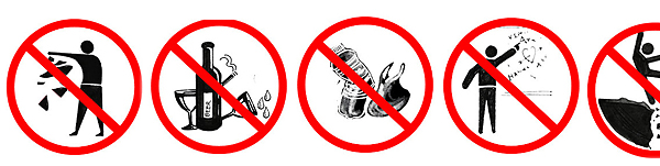 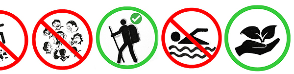 |
| The banner has been published here to improve the awareness of the trekkers and tourists visiting the various mountain forts, mountains in north western ghats. Please avoid accidents, by following good outdoor ethics such as no swimming in cisterns at mountain forts, no rock climbing without proper technical equipment and expertise. Please do not adventure, trek with any group or individually without understanding the risks associated. The frequency of the solo trekker fatalities have increased recently. Please strictly avoid solo treks. Please also avoid treks to mountains in large commercial groups, as it leads to damage to biodiversity of these high elevation ecological islands. Please respect the wildlife and biodiversity of the region. This has become more important as the ever increasing human interference is leading to severe damage to fragile ecosystems. Please be aware of the wildlife and biodiversity of the mountains before visiting these mountains. Please follow outdoor ethics. Follow ASI and Forest department rules. The concept of use of symbols for outdoor ethics was conceived and designed by "Sahyadri Trekker Bloggers Group". |
| |
|
|
| |
  |
| |
| 1. Karad-Chiplun trade route Map, Maharashtra, India |
| |
|
|
| |
  |
| |
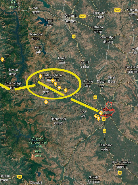
| 2. Map, Koyna Valley Caves, Satara district, Maharashtra, India |
| |
|
|
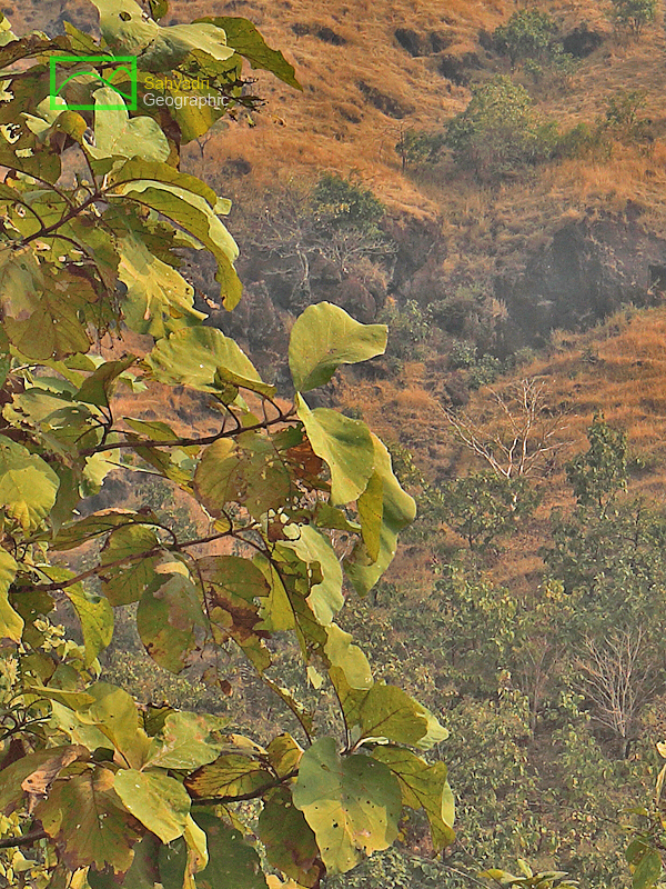
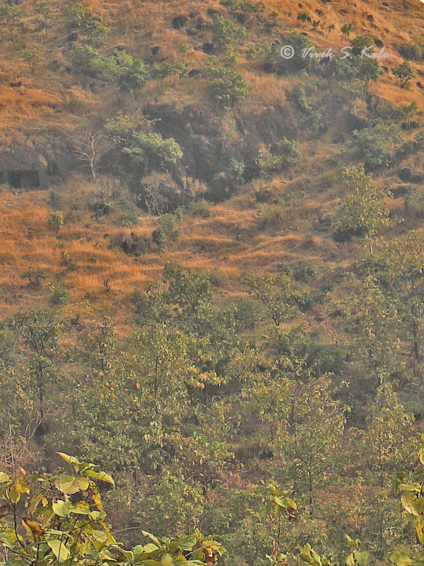
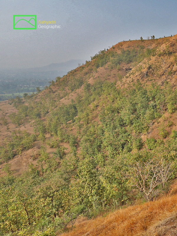
कोयना नदीचा उगम महाबळेश्वर येथे होतो. पुढे दक्षिणेकडे पण घाटमाथ्याजवळच कोयनानगर येथे या नदीवर धरणाची भिंत आहे. इथ पर्यंत उत्तर दक्षिण प्रवास करत आलेली कोयना नदी येथुन पुढे मात्र पश्चिम पुर्व अशी वाहु लागते. कोयनानगर ते कराड या पश्चिम पुर्व पठारी भागातुन जाताना या नदिच्या दोन्ही बाजुस म्हणजे उत्तरेला आणि दक्षिणेला डोंगररांगा आहेत. कोयना नदीच्या उत्तरेकडे असल्या डोंगररांगेत असलेल्या म्हावशी लेण्याची माहिती या सदरात मांडली आहे. सदर लेणी पेठ म्हावशीगावाजवळ असलेल्या डोंगरात आहेत.
प्राचिन काळी अंदाजे २००० वर्षांपुर्वी भारताचा व्यापार इजिप्त, ग्रीक राज्यांबरोबर होत असे. दक्खन च्या पठरावरुन वस्तु कोकणातील बंदरंपर्यंत पोहोचवल्या जात. तेथुन पुढे समुद्रमार्गे ब्यापार होत असे. कराड हे महत्वाचे व्यापारी केंद्र होते. येथुन माल कोकणापर्यंत चिपळुण आणि इतर ठिकाणाच्या खाड़्यांपर्यंत पोहोचत असे. या व्यापारी मार्गा च्या आजुबाजुला अनेक ठिकाणी बुद्ध लेणी पहावयास मिळतात.
|
|
Koyna river originates at Mahabaleshwar. It has very large dam built on it at koynanagar in Patan tehsil of Satara district. After Koynanagar the river flows towards east before it reaches Karad. This region of Koyananagar to Karad is here considered as Koyna valley. The river flows through a flat basin flanked by hill ranges on either side of it. In this photoessay, one of the caves on the northern side hill range is discussed. Out of six lesser known caves in this northern hill range facing Koyna, Mhavashi is one of the most less visited rock cut cave. The caves are located near the village Peth Mhavashi.
In ancient India about 2000 years back India used to trade with other western civilisations such Persia, Greece and Egypt. The trade used to be carried out by road from Deccan plateay through a trade center till the ports on west coast. The goodswere then transported through sea route to Egypt, Greece etc. The land route from deccan plateu to west coast was decided based on the convenience. Karad was important trade center on the deccan plateau. The goods were transported from Karad to Chiplun and other Konkan ports through Koyna valley and the pass through the wetsern ghats. Hence many buddhist caves can be seen around the Koyna valley due to this trade route from Karad to Chiplun.
|
|
|
| |
  |
| |
| 3. Aerial Map, Koyna Valley Caves, Satara district, Maharashtra, India |
| |
|
|
| |
  |
| |
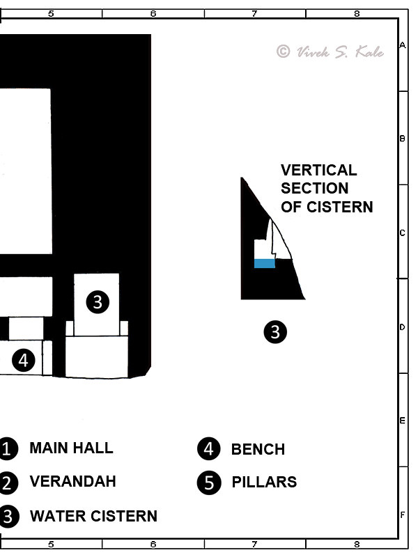
| 4. Layout – Mhavashi Caves, Satara district, Maharashtra, India |
| |
|
|
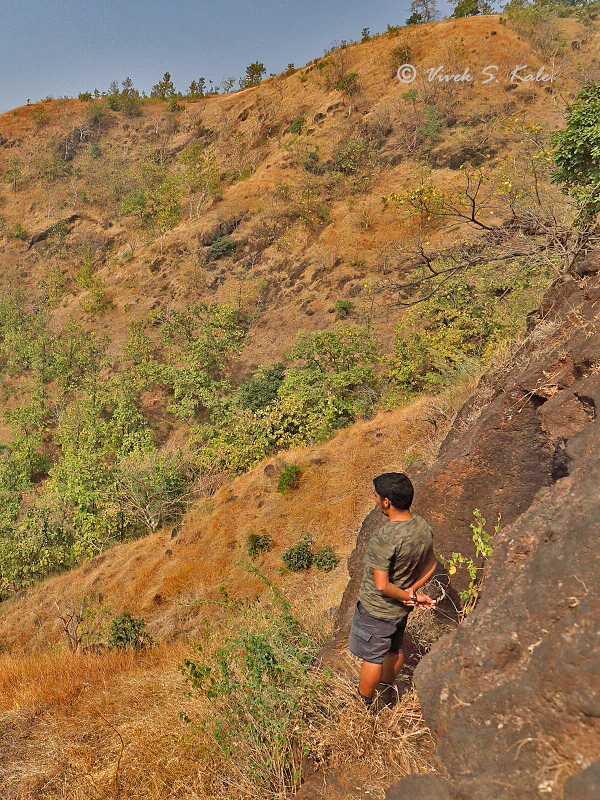
कोयनानगर-कराड रस्त्यावर पेठ म्हावशी एक मोठे गाव आहे. सकाळ लवकर आम्ही पेठ म्हावशी ला पोहोचलो. या गावाजवळच्या डोंगरात म्हावशी लेणी आहेत. म्हावशी पेठ हे एक लांब लचक पेठे सारखे पट्टी च्या आकाराचे गाव आहे.
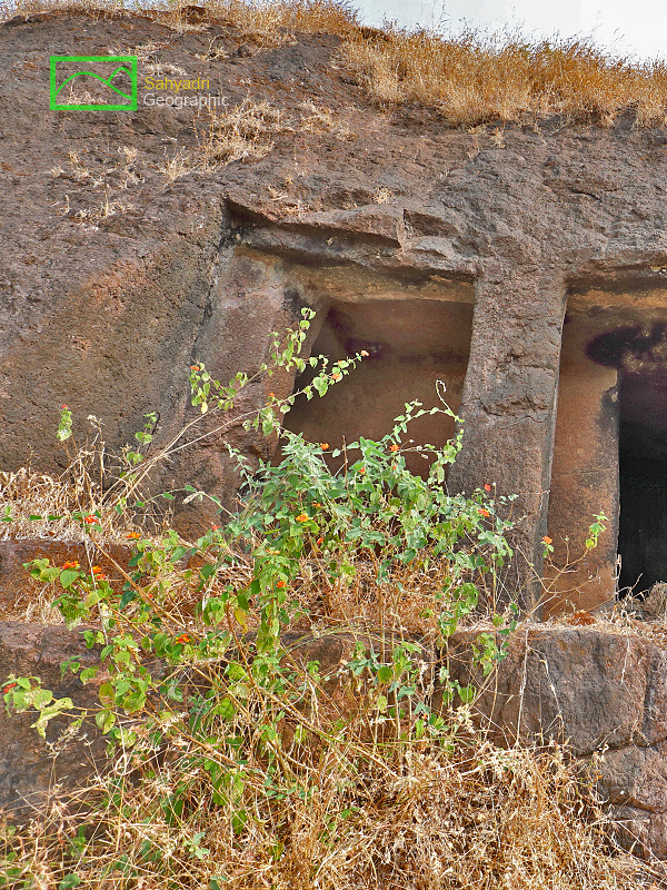
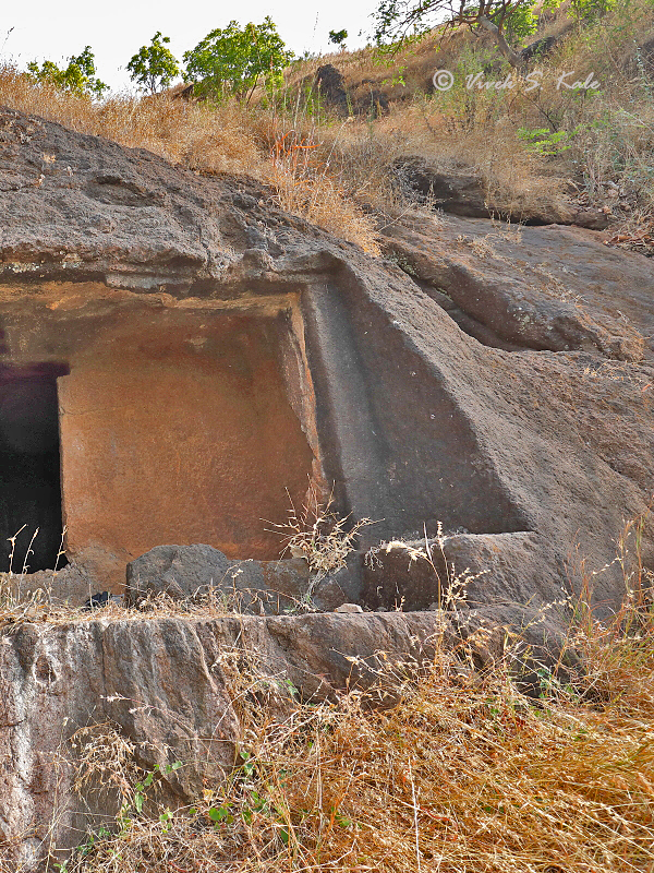
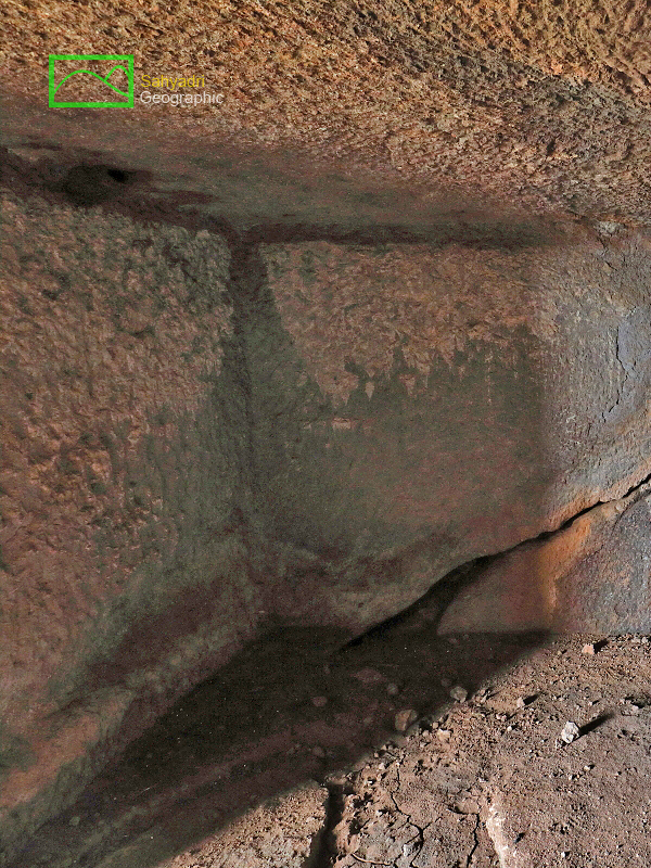
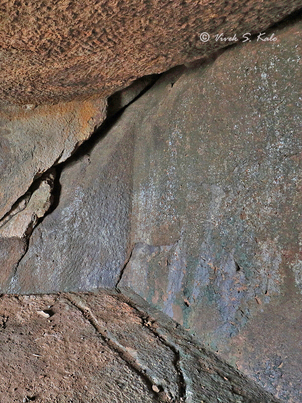
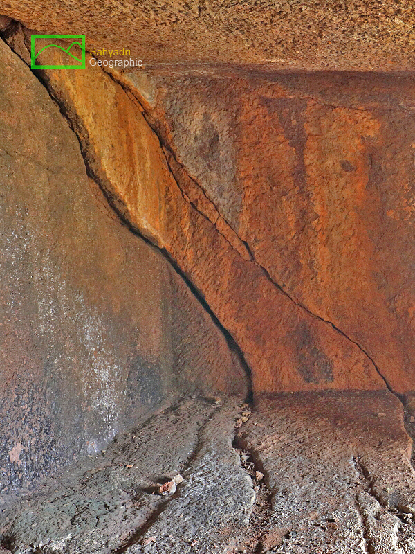
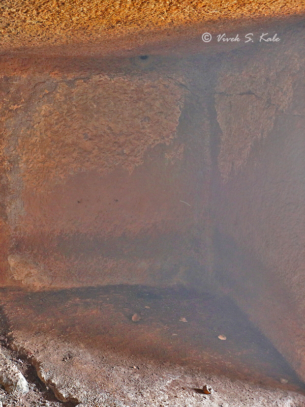
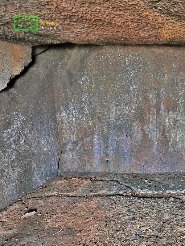
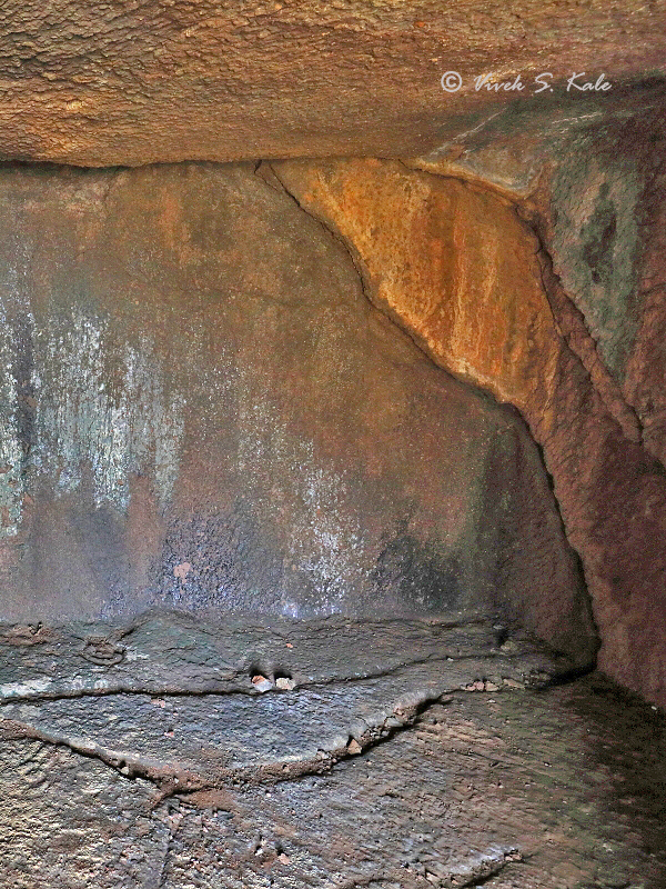
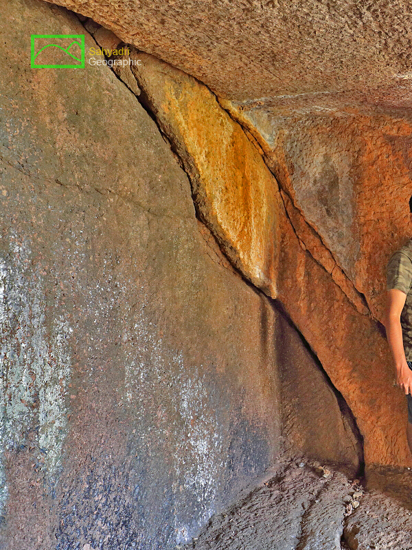
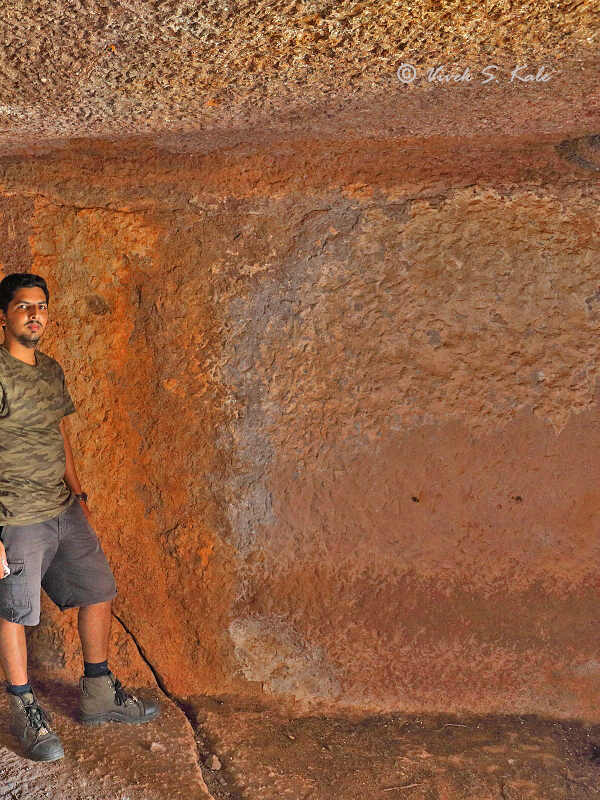
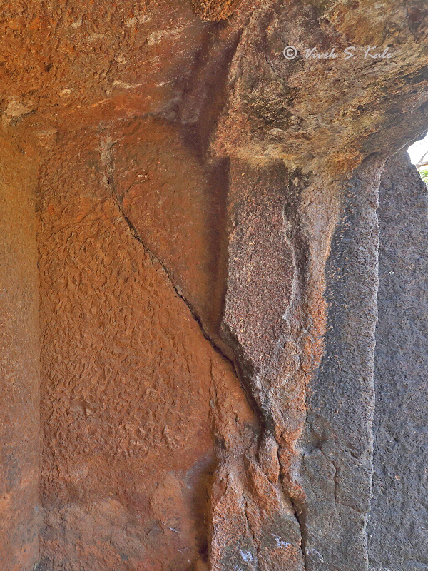
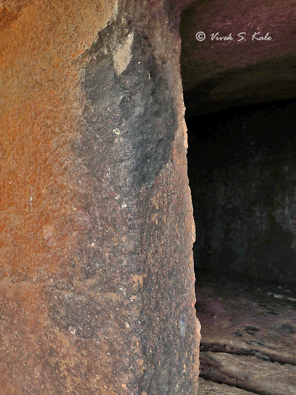
चिंचोळ्या रस्त्यांवरुन आमची गाडी पेठेत आली. अरुंद रस्ता आणि चिंचोळे गाव. पुढे रस्ता खणुन ठेवला होता. त्यामुळे गाडी बाजुला मोकळ्य़ा जागेत लावुन आम्ही पायी निघालो. गाव ओलांडले, सहाजिकच चौकश्या झाल्या. गावातल्या रस्ताने आम्ही चौकशी करत गावाच्या मागच्या बाजुला गेलो. डोंगरावर गुहा लेणे कुठे आहे असे उगाच माहित असताना विचारले. थोड़्या गाव गप्पा नंतर आम्ही गावाच्या मागच्या बाजुला पोहोचलो. इथे लांब डोंगर रांग होती. लेणे मात्र दिसत नव्हते. मोकळ्या शेतातुन तिरपे जात आम्ही एका विहिरिवर पोहोचलो. विहिरीत तरंगणाऱ्या बेडकांचा हेवा करत आम्ही माळावरच्या काटेसावराखाली पोहोचलो. सकाळच्या उन्हात बहरलेला काटे सावर स्वप्नवत वाटात होता. बाजुच्या एका डोंगराची धर मध्येच उतरली होती. त्यावर चढलो. याच्या समोर आलेल्या एका आडव्या धारेमुळे लेणी गावतुन दिसत नाही. मधल्या आडव्या धरेवर आल्यावर मात्र लेणी दिसु लागली. समोरच्या डोंगरावरच्या म्हावशी लेण्याने दुरदर्शन दिले. येथुन पुढे कच्च्या रस्त्याने डोंगरपायथा गाठला. मी इथे पुर्वी आलेलो होतो. लेणी डोंगराच्या आतल्या बाजुला आहे. अर्धा तास आडवे चालल्यावर आम्ही डोंगराच्या पायथ्याला पोहोचलो. छातीवरची चढण चढताना अधुन मधुन गवताच्या झिंज्या पकडाव्या लागतात. येथे एक लेणे आहे. आत मध्ये एक दरवाजा असलेले मोठे दालन आहे. दालनाचा आकार अंदाजे ४.५ मीटर x ३.५मीटर आहे. दुर्दैवाने आतल्या मागच्या भिंतीत कातळात मोठी नैसर्गिक भेग आहे. यातुन पाणी आत येत असणार. यामुळे या लेण्याचे काम अर्धवट सोडले आहे. लेण्याच्या दर्शनी भागात एक पडवी आहे. पडवीच्या दर्शनी भागात दोन पुर्ण आणि दोन अर्ध खांब आहेत. खांब चौकोनी आहेत. अर्ध खांब आणि पुर्ण खांब यांच्या मध्ये बसण्यासाठी बाक आहेत. कोपऱ्यात पडवीबाहेर सुद्धा दोन बाक आहेत.एका बाजुचा पुर्ण खांब तुटला आहे. लेण्याची रचना गांधारपाले लेणीसमुहातील काही लेण्यांसारखी आहे. म्हावशी ची लेणी गांधार पाले लेण्याच्या काळातील असावीत. अशा प्रकारच्या लेण्याला "मटप" किंवा "मंडप" असे म्हणतात. अशा मंडपात बौद्ध भिक्षुक एकत्र येत असत. अशा ठिकाणांचा वापर सामुदायिक कार्यक्रम आणि विधी करण्यासाठीहोत असावा. असे मंडप महाड च्या गांधरपाले लेण्यात आहेत. त्याचा काळ इसविसनानंतर तिसऱ्या किंवा चौथ्या शतकातला असावा. या लेण्यात कोणतीही मुर्तीकला नाही. एकुणच येथील वास्तुरचनेवरुन हे तिसऱ्या किंवा चौथ्या शतकातील हिनायन लेणे आहे हे स्पष्ट आहे.
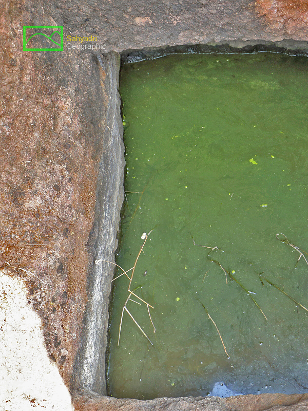
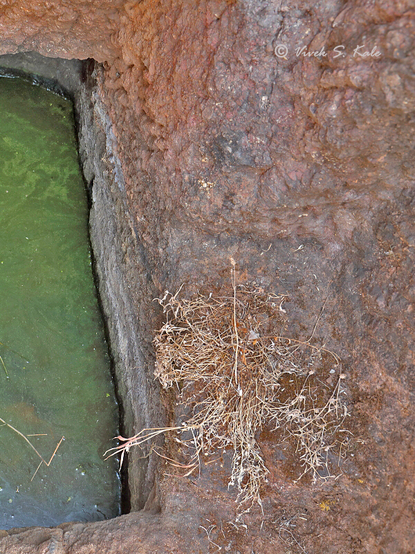
लेण्याच्या पुर्व बाजुस थोडे उंचावर एक पाण्याचे टाके आहे. टाके अर्धवट खोदेलेले आहे.
|
|
Mhavashi Peth is a village on the Karad-Patan highway. The Mhavashi Peth village is long Peth kind of village which is established in a long narrow strip format. We reached the village early in the morning. The narrow road passing through the village was dug up. So we decided to park the vehicle on the way in a open area. Though I was aware of the location of the cave, we still enquired about the whereabouts of the cave. This helps in having a dialogue with locals. After the enquiry we proceeded to the back side of the village on foot. One can not see the caves from here. There is a hill in between. We crossed some barren fields to reach a well in which we were forced to envy the bull frogs who were enjoying their floating on the water. Afer a while we reached a Kateswar tree which was in full bloom in its red flowers. The caves are located at about 60-70 meter altitude above the surrounding plateaue. After scrambling through the village long road, we could reach very close to the base of the hill range on a rough road. From here it took hardly 30 minutes to reach the base of the hill. The cave can not be seen from distance due to a intermediate hillock. Once you reach top of the hillock, the cave can be seen from distance. One can approcah cave from the right side.
This is a single cave. The cave is incomplete due to a large defect in the rock which can be seen inside the cave. The hall is large and is about 4.5 meter by 3.5 meter in size. There is a verandah outside the cave. The cave verandah is typical verandah one can see in the caves at Gandhar Pale caves. There are 2 full and 2 semi pillars in the front architecture of verandah. One of the full pillar is broken. There is a place to seat between pillars and semipillars on either side. The pillars are having rectangular cross section. This cave must be from the same era or later era as that of Gandhar Pale caves. (3rd or 4th century AD). The cave hall is typically called as”matapa” or Mandapa which was mainlyusedfor rituals and activities involving congragations. Though not usable in rainy season due to defect inside, itmay have been used in other dry seasons. As this cave does not have any sculptures, it is a late Hinayana Cave.
There is also a water cistern on the east side of the cave. The cistern is incompletely carved.
|
|
|
| |
  |
| |
| 5. Mhavashi Caves from distance, Satara district, Maharashtra, India |
| |
|
|
| |
  |
| |
| 6. Mhavashi Cave as seen from the base of the hill, Satara district, Maharashtra, India
|
| |
|
|
| |
  |
| |
| 7. Mhavashi Cave as seen from base of the hill, Mhavashi Caves, Satara district, Maharashtra, India
|
| |
|
|
| |
  |
| |
| 8. Mhavashi cave front view, Satara district, Maharashtra, India
|
| |
|
|
| |
  |
| |
| 9. Mhavashi Cave hall, Satara district, Maharashtra, India |
| |
|
|
| |
  |
| |
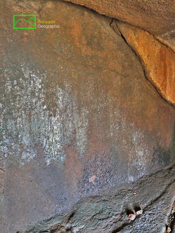
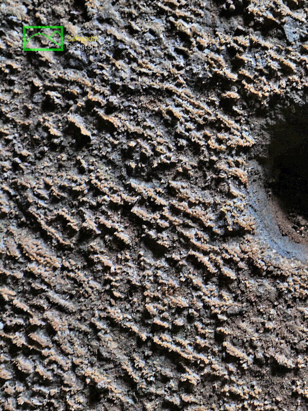
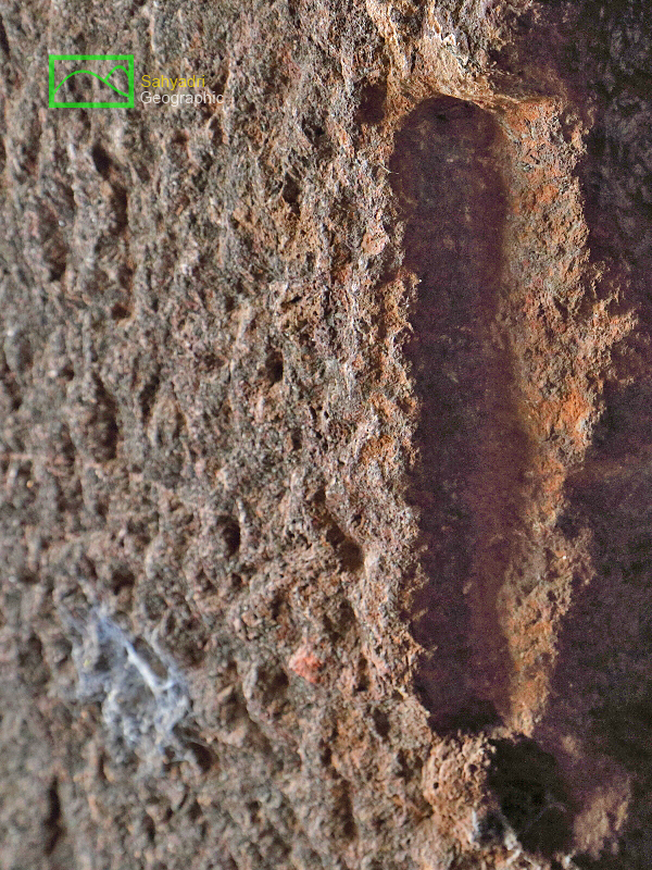
| 10. Defect crack in Rock, Mhavashi Caves, Satara district, Maharashtra, India |
| |
|
|
| |
  |
| |
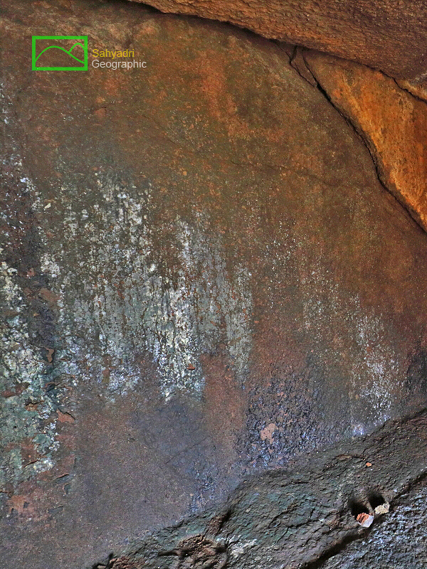
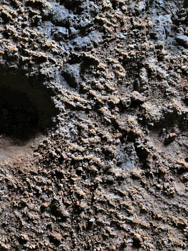
| 11. Defect crack in Rock, Mhavashi Cave, Satara district, Maharashtra, India |
| |
|
|
| |
  |
| |
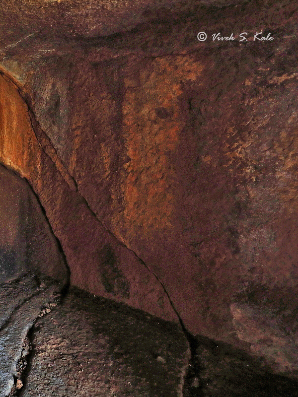
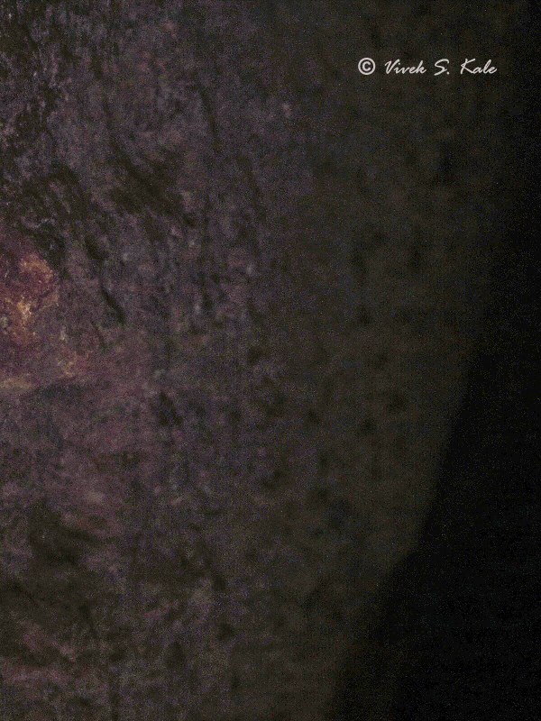
| 12. Mhavashi Cave, Satara district, Maharashtra, India |
| |
|
|
| |
  |
| |
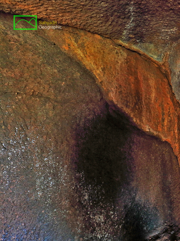
| 13. Mhavashi Cave, Satara district, Maharashtra, India |
| |
|
|
| |
  |
| |
| 14. Mhavashi Cave, Satara district, Maharashtra, India |
| |
|
|
| |
  |
| |
| 15. Sadaf at Mhavashi Cave, Satara district, Maharashtra, India |
| |
|
|
| |
  |
| |
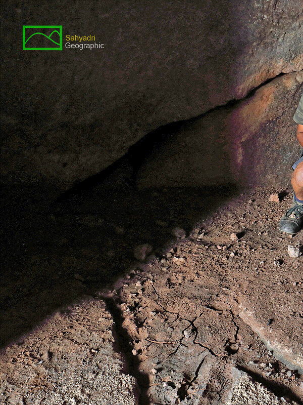
| 16. inside out, Mhavashi Caves, Satara district, Maharashtra, India |
| |
|
|
| |
  |
| |
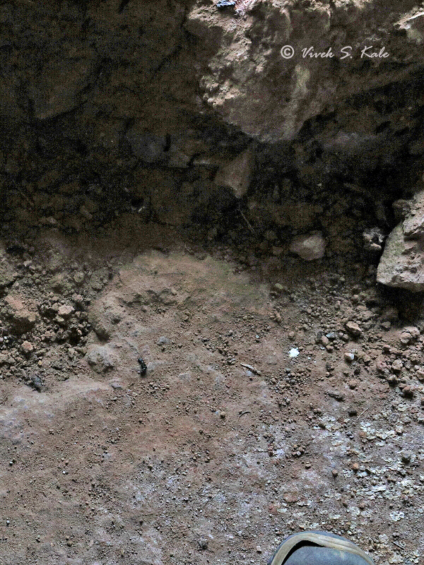
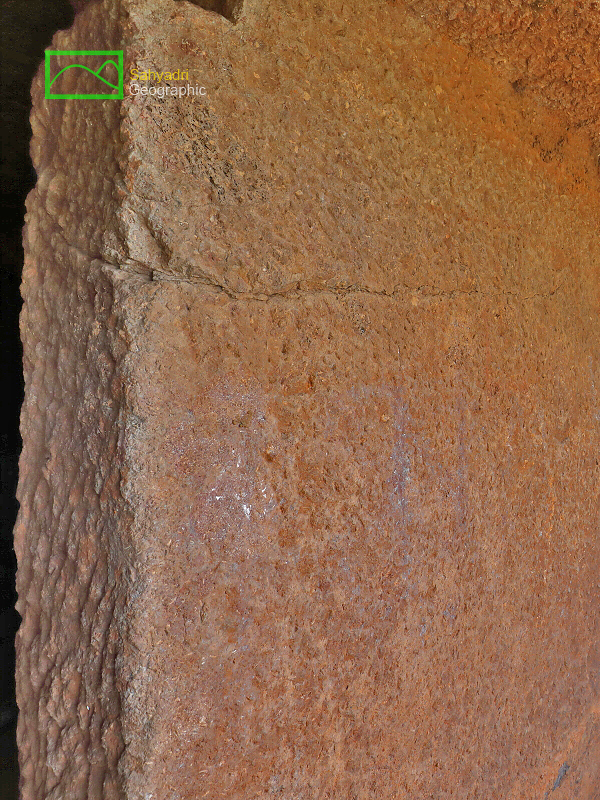
| 17. Post hole, Mhavashi Cave, Satara district, Maharashtra, India |
| |
|
|
| |
  |
| |
| 18. Post hole, Mhavashi Cave, Satara district, Maharashtra, India |
| |
|
|
| |
  |
| |
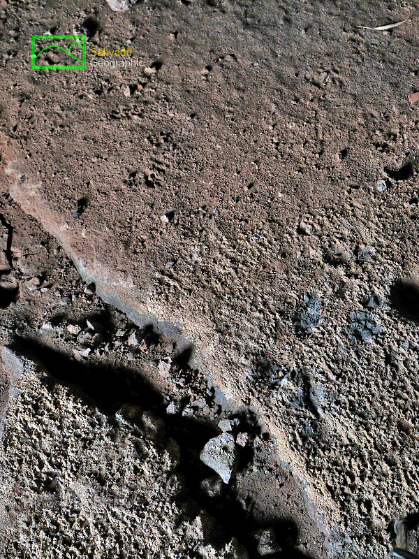
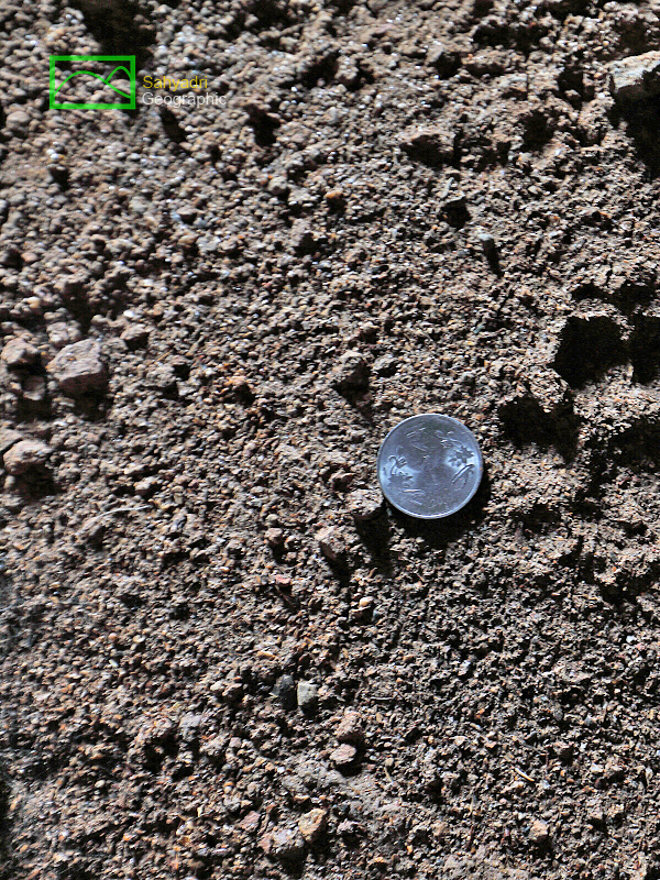
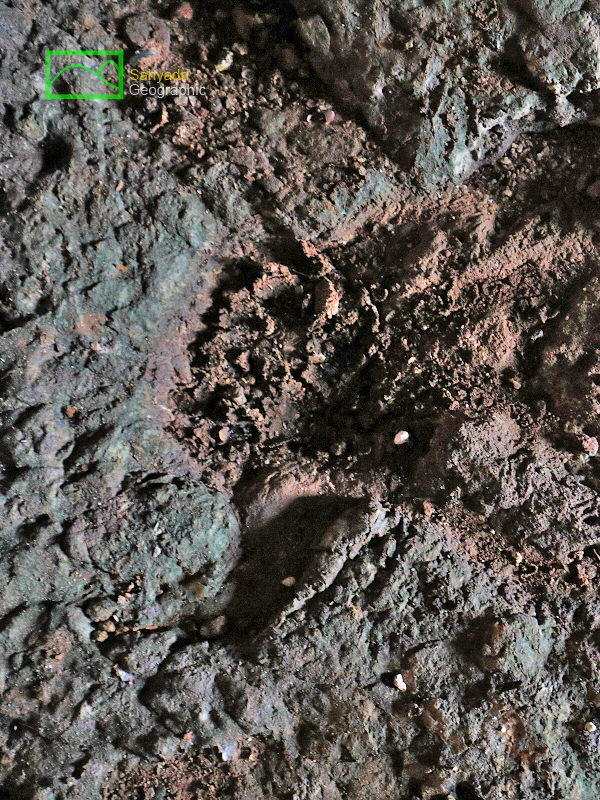
| 19. Pug marks of cat family animal, Mhavashi Cave, Satara district, Maharashtra, India |
| |
|
|
| |
  |
| |
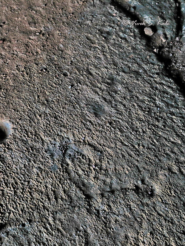
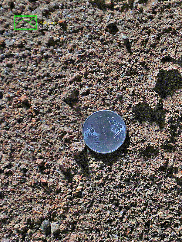
| 20. Small shivalingam mark, Mhavashi Cave, Satara district, Maharashtra, India |
| |
|
|
| |
  |
| |
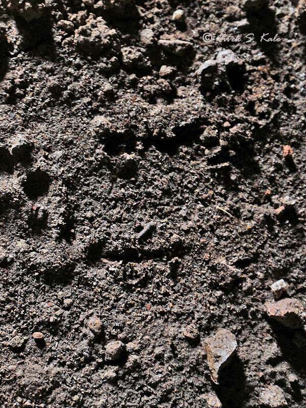
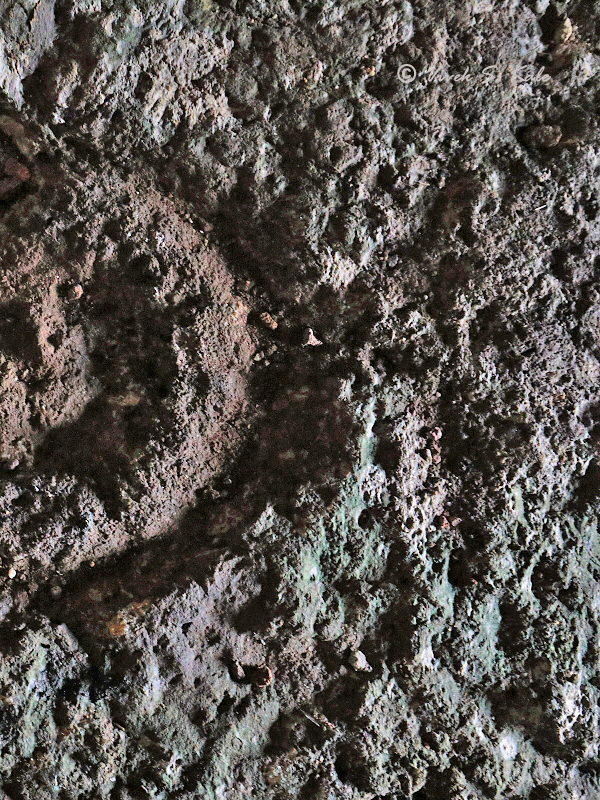
| 21. Pug mark of car family animal, Mhavashi Caves, Satara district, Maharashtra, India |
| |
|
|
| |
  |
| |
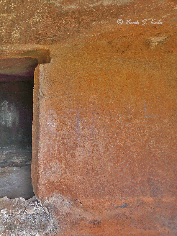
| 22. Post holes at Door, Mhavashi Cave, Satara district, Maharashtra, India |
| |
|
|
| |
  |
| |
| 23.Post notch at door, Mhavashi Cave, Satara district, Maharashtra, India |
| |
|
|
| |
  |
| |
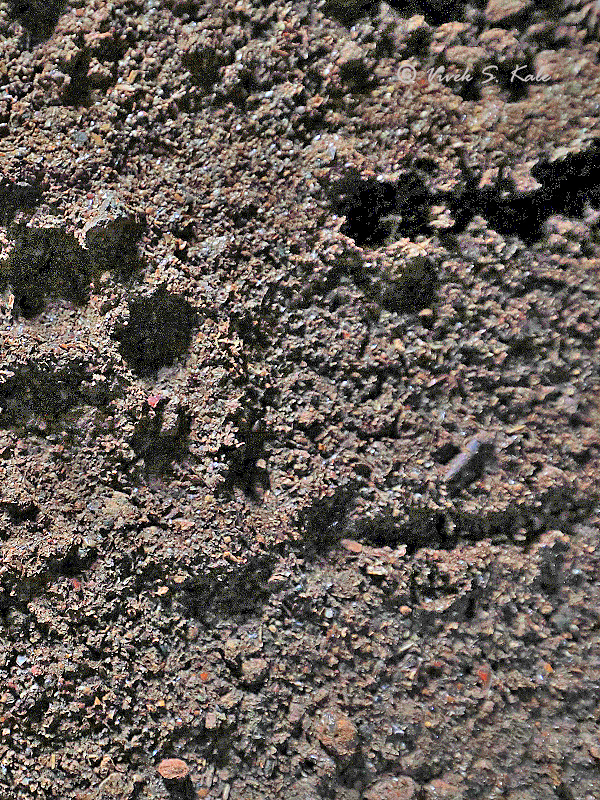
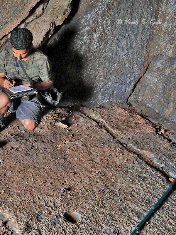
| 24. Sadaf making notes of pugmarks for identification, Mhavashi Cave, Satara district, Maharashtra, India |
| |
|
|
| |
  |
| |
| 25. Main doorway, Mhavashi Cave, Satara district, Maharashtra, India |
| |
|
|
| |
  |
| |
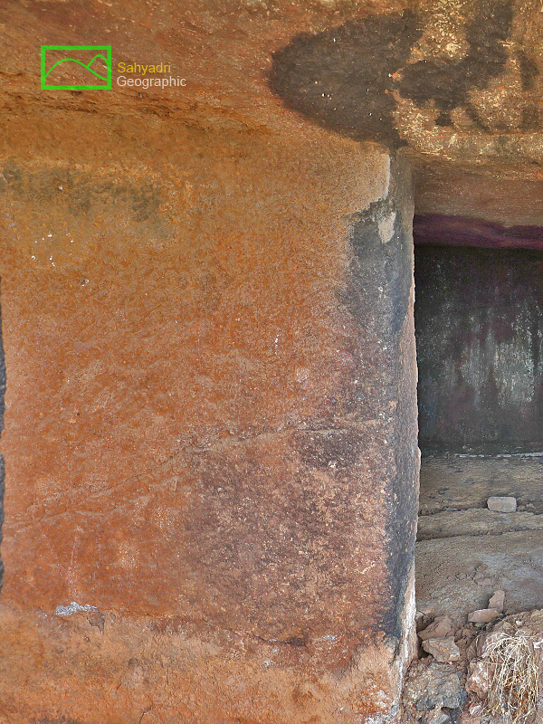
| 26. Verandah right (east) side wall, Mhavashi Caves, Satara district, Maharashtra, India |
| |
|
|
| |
  |
| |
| 27. Verandah left side (west) wall with niche, Mhavashi Caves, Satara district, Maharashtra, India |
| |
|
|
| |
  |
| |
| 28. Water cistern, Mhavashi Cave, Satara district, Maharashtra, India |
| |
|
|
| |
  |
| |
| 29. Water cistern, Mhavashi Cave, Satara district, Maharashtra, India |
| |
|
|
| |
  |
| |
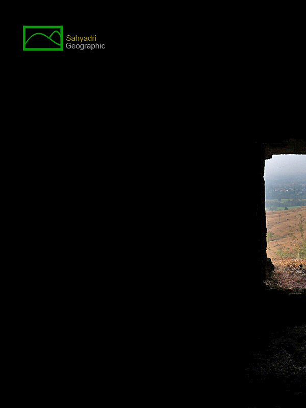
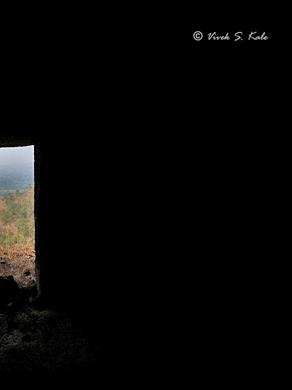
| 30. View from Mhavashi Cave, Satara district, Maharashtra, India |
| |
|
|
| |
  |
| |
| 31. Pilgrims under bloomed Savar tree , Mhavashi Cave, Satara district, Maharashtra, India |
| |
|
|
| |
  |
| |
| 32. Pilgrims looking at the hills around, Mhavashi Cave, Satara district, Maharashtra, India |
| |
|
|
| |
  |
| |
| 33. Pilgrims, Mhavashi Cave, Satara district, Maharashtra, India |
| |
|
|
| |
  |
| |
| 34. Pilgrims at Incomple cave, Mhavashi Caves, Satara district, Maharashtra, India |
| |
|
|
| |
 |
| |
|
|
References :
1. Cave temples of India, London, 1880, Fergusson James and Burgess James.
2. Gazetters of Bombay Presidency, Satara District, Volume XVIII, 1885.
3. Buddhist architecture of western India, 1981, S. Nagraju.
4. Caitya Halls: Evidence of a Rock-Cut Architectural Tradition in the Vicinity of Karāḍ, Southern
Mahārāṣṭra, David Efurd, 2006
5. Late Hinayan Caves of western India - M.K. Dhavalikar, 1984
|
| |
|
|
| |
|